How to Get to Koh Chang How to Get to Koh Chang |
|
|
| Trat Airport |
|
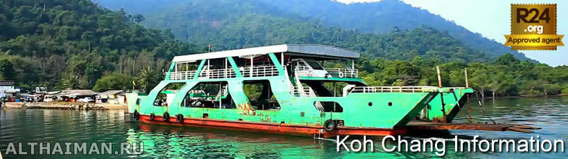
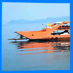 To get to Koh Chang, you first need to get to Trat province by air, bus or auto and already there will take a ferry to the island from one of the three piers.
 Read more... Read more... |
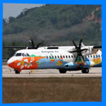 Trat Airport is located 18 km from Ao Thammachat pier and 30 km Laem Ngob Pier. Trat airport is about 60 km from Laem Sork Pier. Bangkok Airways runs to Trat daily from Suvarnabhumi International airport, 2 times a day in low season
Read more... |
|
|
| Kog Chang Geography |
|
| Getting Around Koh Chang |
|
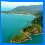 For you information: Koh Chang means "elephant island" in Thai and it's the largest among 52 islands of Trat province. Koh Chang is a beautiful beaches, coral reefs and abundant marine life. The island is also rich in natural resources... For you information: Koh Chang means "elephant island" in Thai and it's the largest among 52 islands of Trat province. Koh Chang is a beautiful beaches, coral reefs and abundant marine life. The island is also rich in natural resources...
Read more... |
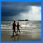
 Because of its great size, climate and mountainous terrain, Koh Chang is not the best place to walk. Most of the beaches, separated by steep slopes are a good distance from each other, the roads have a tendency to be
Read more... Because of its great size, climate and mountainous terrain, Koh Chang is not the best place to walk. Most of the beaches, separated by steep slopes are a good distance from each other, the roads have a tendency to be
Read more... |
|
|
| Koh Chang Weater & Climate |
|
| Festival & Events in Koh Chang |
|
 Due to its geographical location the weather in Koh Chang is highly variable. Island unlike the rest of Thailand has 2 seasons. Most visitors travel to Koh Chang between november and april, it is also the best time to visit
Read more... Due to its geographical location the weather in Koh Chang is highly variable. Island unlike the rest of Thailand has 2 seasons. Most visitors travel to Koh Chang between november and april, it is also the best time to visit
Read more... |
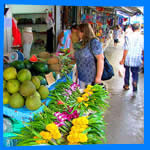
 Thais are very funny and sentimental people. Therefore annual festivals, memorial days and holidays play an important role in their lives. Many Thai festivals are fun and colorful and Thais always
Read more... |
| |
|
|
| Trat City |
|
| Koh Chang Map |
|
 Trat province is located on the eastern border of Thailand, 315 kilometers from Bangkok. The province is located between Chantaburi and Cambodia and adjacent to Golf of Siam... Trat province is located on the eastern border of Thailand, 315 kilometers from Bangkok. The province is located between Chantaburi and Cambodia and adjacent to Golf of Siam...
Read more... |
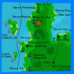 Our interactive detailed Koh Chang map showing all hotels, their exact location on the island, as well as the surrounding roads, restaurants, bars, attractions and useful landmarks. Koh Chang Maps is the fastest way to choosing your Our interactive detailed Koh Chang map showing all hotels, their exact location on the island, as well as the surrounding roads, restaurants, bars, attractions and useful landmarks. Koh Chang Maps is the fastest way to choosing your
Read more... |
 About Koh Chang information: this is second largest island in Thailand, 30 km length and 14 km width and it's located near Cambodia border in Trat province, 312 km from Bangkok. Now Koh Chang has become one of the most popular Thailand holiday destination.